Vizart’s Cartography Corner

Questo articolo esplora il processo di restauro digitale di una mappa storica di Milano del 1910, evidenziando le principali sfide legate al restauro di mappe antiche, come sezioni mancanti, macchie dovute al tempo, pieghe e degrado del colore. Attraverso un caso di studio reale, mostra come la ricerca storica e il confronto con le mappe d'archivio possano recuperare dettagli perduti, inclusi i nomi delle strade originali. Il restauro della mappa viene presentato come un primo passo cruciale per trasformare una mappa antica in un'opera d'arte moderna in rilievo ombreggiato che rimanga storicamente accurata, pur ottenendo un rinnovato impatto visivo.

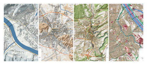
This project showcases the creation of four custom city maps commissioned as 80×60 cm fine art prints on matte paper. Each map was designed with a unique color scheme, complementary tones across pairs, and detailed representation of major roads. The challenge was to translate the client’s vision into precise cartographic artwork. Using OpenStreetMap data combined with LIDAR elevation data, we crafted maps that blend accuracy, design, and artistic expression.

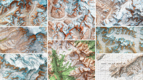
A showcase of the 10 highest mountains in the United States through the USGS shaded‑relief maps from the 1960s and ’80s, created by Vizart.


