


There are mountains that have a name. And then there is Denali, which for more than a century seems to have had at least two.
At 6,190 metres, it is the highest mountain in North America, rising over the Alaska Range with a presence that is hard to ignore. But its story is not only one of ice, expeditions and immense mountain walls. It is also a story of Indigenous languages, gold prospectors, American politics and cartography. And part of that story can be read through three maps published in 1964, 1982 and 1986.
Long before anyone began drawing contour lines or the boundaries of a national park, Alaska Native peoples already had their own names for the mountain. “Denali” comes from the Koyukon word deenaalee, a term that can be translated approximately as “the high one” or “the tall one”. Koyukon is one of the Athabascan languages traditionally spoken to the north of the Alaska Range. And Denali was not the only Indigenous name for the mountain: several Alaska Native groups used their own names for it, often linked to the ideas of height or greatness.
The story began to change with the arrival of European explorers and, later, gold prospectors. One of the earliest known European references dates back to 1794, when George Vancouver saw from a distance what he described as enormous snow-covered mountains. During the Russian period, other names circulated and, after the United States purchased Alaska in 1867, increasing numbers of explorers, traders and gold seekers began arriving in the region. Towards the end of the nineteenth century, the name “Densmore Mountain”, after the prospector Frank Densmore, was also used for a time.
The name that would remain on American maps for most of the twentieth century appeared in 1896, and it came about in rather unusual circumstances. William Dickey was a gold prospector and, like many Americans at the time, was caught up in the major political debates of the day. In the United States, monetary policy was a particularly heated issue: on one side were supporters of the gold standard, and on the other advocates of so-called free silver. William McKinley, the Republican presidential candidate, was associated with the pro-gold position, while William Jennings Bryan represented the opposing side.
Dickey supported McKinley. According to a historical account by the National Park Service, he later explained that he had become involved in heated arguments with supporters of silver during his journey through Alaska. His response was rather unusual: he attached the name of the politician who shared his own political position to the great mountain before him. And so he began calling it Mount McKinley.
In January 1897, Dickey used the name publicly in an article in the New York Sun. McKinley had just become president. The curious part is that he had no particular connection with Alaska: he had never explored the region and had played no role in the history of the mountain itself. After his assassination in 1901, however, the name gained further weight and eventually became officially established.
Not everyone stopped calling it Denali. One of those who openly opposed the name McKinley was Hudson Stuck, an Episcopal missionary and one of the members of the first documented ascent of the mountain’s main summit. In 1913, Stuck reached the top with Harry Karstens, Robert Tatum and Walter Harper. Harper was only twenty years old and was the first of the group to step onto the summit. Stuck continued to prefer the name Denali and, in his 1914 book The Ascent of Denali, openly argued that the mountain should be restored to its old Indigenous name.
Three years later, however, “McKinley” also became part of the name of the park. In 1917, Mount McKinley National Park was established, and for many decades that remained the official name used on federal maps.
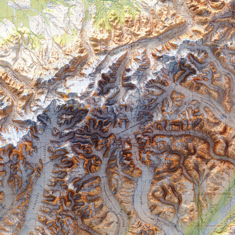
The three maps shown below may represent the same broad area, but they capture very different moments in this story.
The 1964 map brings the viewer closest to the mountain itself. It is the Mount McKinley A-3 topographic quadrangle, produced by the U.S. Geological Survey at a scale of 1:63,360. Of the three, it gives the clearest impression of being inside the mountain landscape. Glaciers, ridges, valleys and contour lines fill the sheet, and the terrain seems almost compressed around the mountain.
Of the three maps, this is perhaps the one that most strongly retains the spirit of exploration. Looking at it, it is easy to imagine a paper map spread across a table during an expedition.
In 1964, there was still no ambiguity in the official name: to the federal government, the mountain was Mount McKinley, within Mount McKinley National Park.

The 1982 map tells a very different story. By then, the State of Alaska had formally requested that the mountain be renamed Denali, but the proposal had faced long-running political opposition, particularly from representatives of Ohio, William McKinley’s home state.
In 1980, a kind of compromise had been reached: the park was renamed Denali National Park and Preserve, while the mountain itself officially remained Mount McKinley.
It is interesting to think of the 1982 map as having been produced during precisely this period of transition. Visually, it is also very different from the earlier map. Its 1:250,000 scale widens the view and turns the mountain from the sole protagonist into the highest point within a much broader landscape.
Valleys, rivers, plains and the larger structure of the mountain range become much more visible.

If the 1964 map seems to take you almost onto the mountain, the 1982 map steps back and shows you where it sits. It is probably the one that best conveys one of Denali’s most striking qualities: not only its height, but the sheer vastness of Alaska around it.
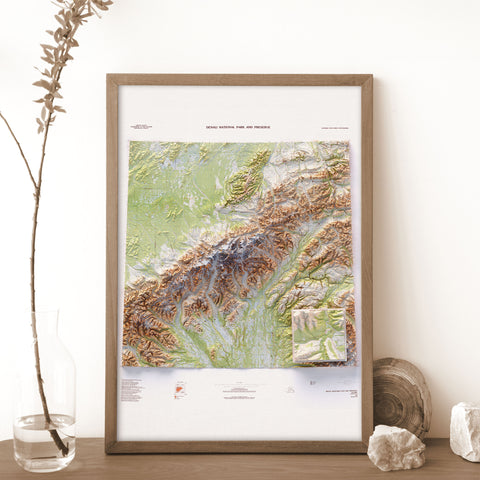
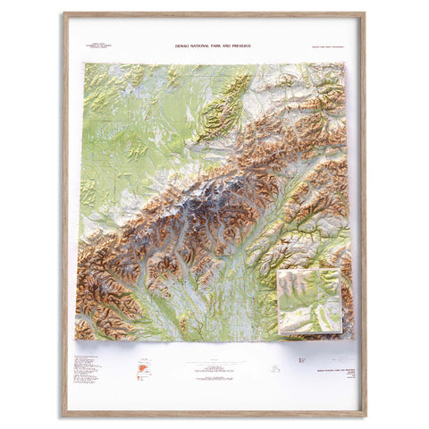
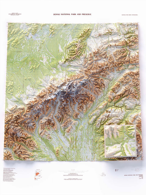
The 1986 map shifts the perspective once again. It belongs to the U.S. Geological Survey’s National Parks series and is explicitly dedicated to Denali National Park and Preserve. Here the main subject is no longer simply the summit, but the territory as a whole.
The great mountain range runs through the map almost like a backbone, while the surrounding landscape seems to open out around it.
It is perhaps the most scenic of the three. It also carries a small historical oddity: in 1986, you could be standing in Denali National Park and Preserve, looking at a mountain that the federal government still officially called Mount McKinley.
That compromise would last for almost another thirty years.

In 2015, the U.S. federal government officially restored Denali as the name of the mountain. It was a name already used for many years by the State of Alaska and one deeply rooted in local culture. It seemed as though a debate that had begun more than a century earlier had finally come to an end, but it had not.
In January 2025, President Donald Trump ordered the name Mount McKinley to be restored for the mountain, and the Department of the Interior made the change effective for federal use. The park, however, kept the name Denali National Park and Preserve.
And this is perhaps the most curious part of the story: more than a century after William Dickey, the name of the mountain still tells us something about American politics, the relationship with Indigenous peoples, and the way a place can take on different meanings depending on the period in which we look at it.
The maps from 1964, 1982 and 1986 make all of this especially visible.
Different people will find different things in each of them, and each map will have some detail that makes it more appealing than the others to a particular eye.
Some people notice the mountains first. Others follow the rivers across the page, look for familiar place names or lose themselves in the contour lines. And then there are those who, after a few minutes, notice the words “Mount McKinley” and wonder why they are now so used to hearing the name Denali instead.
That is the moment when a map stops being simply an image and becomes a doorway into a story that is still being written.Perhaps that is one of the reasons old maps work so well beyond archives, libraries and mountain huts. You do not need to have been to Alaska to have a map of Denali on your wall.
In fact, sometimes a map works in exactly the opposite way: it does not necessarily remind us of somewhere we have already been, but simply reminds us that such a place exists.
Comments (0)
There are no comments for this article. Be the first one to leave a message!