Exploring Shaded Relief Map Creation
Learn how we craft detailed cartography
WHAT WE DO
Welcome to the creative world of VizCart.io, where the art of map-making comes alive! At VizCart, we don’t just make maps; we craft stories, sculpt landscapes, and bring geography to your fingertips. Our specialty?
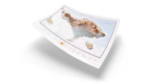
The shaded relief maps – a technique that transforms flat maps into vibrant, three-dimensional journeys.
Shaded relief maps are a fascinating form of cartography that combines art and science to create visually stunning representations of the Earth's surface. These maps use a combination of colors, shading, and contour lines to depict the topography of a specific area, giving the viewer a sense of the terrain's elevation and relief.
Shaded relief maps are particularly unique because they create the illusion of three-dimensionality on a
two-dimensional surface. This is achieved by simulating the effects of light and shadow on the landscape, enhancing the perception of depth and texture.
These maps are created using advanced digital rendering techniques that analyze elevation data and apply shading algorithms to generate realistic representations of the Earth's surface. The result is a visually striking map that not only provides valuable geographic information but also serves as a work of art.
The process
Map restoration
Craft relief
3D enhancing
Final touch
Restoration process
Compare vintage map before & after restoration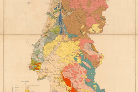
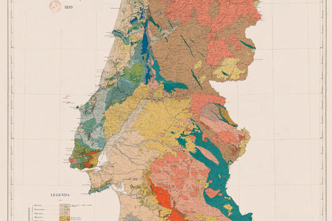
The creation process start with the restoration of the original map. We choose to carry out a non-conservative restoration, joint lines are eliminated, tears stitched, labels reconstructed and colors revitalised
Craft relief
Enjoy details of Mt Rosa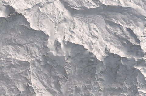
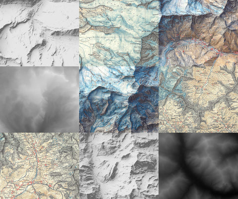
The second step involves the creation of the relief. Starting from a DEM we build-up a 3D model of the terrain of the area of interest
3D enhancing and final touch
Compare vintage map before & after 3D enhancing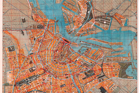
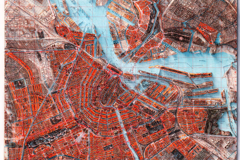
In the third stage we combine the 3D model with restored map to create the shaded relief effect. Finally, we give a final touch adjust lights, colors and shadows intensity.