For this project we created the design of one of two maps requested by a private client, intended to be printed in a 140 x 100 cm format on matte paper.
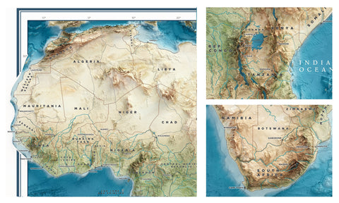
A map of Africa with bathymetric and elevation surveys, with a clean design and embossed shadows clear enough to read each label on it.
As usually our work starts with DEM elaboration and the colour map design. Then we realized the cartography grid, borders and so on.

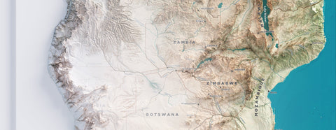
Once the greens have been balanced and we are satisfied with the color of the rivers and lakes, we test the relief and map color on it.

|
 |
At this point we have a nice map art, but it doesn't fit to our request. To turn this in a travel map, we need labels!
Now we are ready to setup the topographic elements like roads, borders, cities and towns and their names.


At this point we are ready to show the final map.

Comments (0)
There are no comments for this article. Be the first one to leave a message!