Welcome back to our blog, where we continue to explore the fascinating world of vintage maps. Today, we’re embarking on a special journey, one that will take us through the rugged terrains and breathtaking landscapes of the Alps, as depicted in some of the most detailed and historical maps available on our website, Vizcart.
In this post, we’ll be delving into the intricacies of eight distinct maps, each representing a unique part of the Alpine region. From the towering peaks of Mont Blanc and Monte Rosa to the serene valleys of Acceglio and Valgrisenche, these maps offer a rich tapestry of geographical features and historical significance.
Each map in our collection tells a story, not just of the land it represents, but also of the time it was created and the cartographer who brought it to life. We’ll discuss the creators of these maps, the years they were published, and the unique elements that make each map a treasure in its own right.
So, buckle up and prepare for an exciting journey through time and space as we traverse the Alps, one map at a time. Whether you’re a seasoned cartographer, a history enthusiast, or simply a lover of beautiful landscapes, we’re sure you’ll find something to pique your interest in this post.
Stay tuned as we begin our exploration with our first map, a detailed representation of the highest mountain in the Alps, Mont Blanc.
1. Mont Blanc Geological Map (1898)

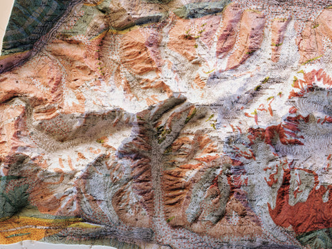
Let’s start our journey with the Mont Blanc Geological Map from 1898. This map is not just a topographical representation of the highest mountain in the Alps, but it’s a geological map, offering a unique perspective on the mountain’s geological features.
The Mont Blanc is the highest mountain in the Alps and Western Europe, and the highest mountain in Europe outside the Caucasus mountains, rising 4,805.59 m above sea level. It’s located on the French-Italian border and is the second-most prominent mountain in Europe, after Mount Elbrus. The mountain gives its name to the Mont Blanc massif, which straddles parts of France, Italy, and Switzerland.
This map, printed with a 3D effect, provides a detailed view of the geological features of Mont Blanc. The map’s creator has meticulously captured the mountain’s geological features, providing a unique perspective of this iconic peak. The map’s intricate details offer a glimpse into the mountain’s diverse rock and stunning natural beauty.
Stay tuned as we continue our exploration with our next map!
2. Monte Rosa Topographic Map (1899)

Continuing our journey, we arrive at the Monte Rosa Topographic Map from 1899. This map is a testament to the art of topography, offering an in-depth view of Monte Rosa, the second highest peak in the Alps and Western Europe, and the tallest in Switzerland.
Monte Rosa, straddling the border between Italy and Switzerland, is renowned for its sprawling mountain massif and lofty average altitude. The map, rendered with a 3D effect, presents a comprehensive portrayal of the mountain’s varied peaks, encapsulating its awe-inspiring natural splendor.
The creator of this map has masterfully depicted the topographical features of Monte Rosa, making it an invaluable resource for those captivated by the mountain’s unique landscape. Whether you’re an experienced mountaineer, a geography aficionado, or simply someone who appreciates stunning landscapes, this map is bound to hold your interest.
Next one!
3. Matterhorn and Monte Rosa Topographic Map (1928)
 Our exploration brings us to the Monte Rosa and Matterhorn Topographic Map from 1928. This map is a unique fusion of two iconic Alpine peaks, Monte Rosa and Matterhorn.
Monte Rosa, the towering giant of the Alps and the tallest peak in Switzerland, is juxtaposed with Matterhorn, known for its distinctive pyramidal peak and its status as one of the most recognizable mountains globally.
This topographic map, brought to life with a 3D effect, offers an immersive view of the diverse peaks and valleys of these two mountains. The creator of this map, the Touring Club Italiano, did a wonderful works or art with the color palette and labels.
Next one!
4. Dolomites Topographic Map (1904)

We now turn our attention to a unique piece in our collection, the Dolomites Topographic Map from 1904. This map has been published by Freytag and Berndt, who is well-known Austrian publishing house specialising in cartography.
This particular map does not encompass the entire Dolomites range, but rather focuses on a specific area located around Bruneck, Auronzo, Longarone and Agordo. The Dolomites are renowned for their stunning beauty, with dramatic peaks and deep valleys that offer some of the most picturesque landscapes in the world.
What sets this map apart is its purpose. It was created as a tourist map in 1903, designed to guide visitors through the awe-inspiring landscapes of the Dolomites. The map, with its 3D effect, provides a comprehensive view of the region, showing peaks, valleys, roads, rivers and towns
Next one!
5. Dolomites Topographic Map (1880)

We now venture further into the heart of the Dolomites with the Dolomites Topographic Map from 1880. Unlike the previous map, this one offers a comprehensive view of the entire Dolomites range, providing a broader perspective of this captivating mountain range located in northeastern Italy.
The Dolomites, also known as the Dolomite Mountains, Dolomite Alps or Dolomitic Alps, are a part of the Southern Limestone Alps and extend from the River Adige in the west to the Piave Valley in the east. They are renowned for their dramatic peaks, sheer cliffs, and deep, long valleys.
This map, created before the turn of the 20th century, is a testament to the timeless beauty of the Dolomites. The map, printed with a 3D effect, provides a stunning view of the Dolomites.
Next one!
6. Acceglio Topographic Map (1899)

Our journey now takes us to the Acceglio Topographic Map from 1899. This map is a part of a series of maps published between 1899 and 1902, known as “Carte du versant italien des Alpes”.
Acceglio is a commune located in the Province of Cuneo in the Italian region Piedmont. It’s situated above Prazzo in the upper Valle Maira, about 90 kilometres southwest of Turin and about 45 kilometres west of Cuneo, on the border with France.
This map represents not only the Val Maira, but also Val Grana and Val di Stura, three valleys that are rich in natural beauty and historical significance.
Val Maira, considered an authentic paradise for hikers and excursionists, is a treasure trove of Occitan history and culture and boasts a network of trails connecting secondary valleys and old villages. In the high Val Maira, there is an important trail that connects France and Italy and the respective valleys of Ubaye and Val Maira.
Val Grana, nestled between the Marittime and Cozie Alps, is the smallest of the valleys in the province of Cuneo. It’s a land of transit in Roman times and a land contested between the Marquisate of Saluzzo and the Angevins, and then fell under the Savoy dominion.
Val di Stura, located between the Maritime Alps and the Cozie Alps, has always been a cradle of precious experiences and attitudes. In the high Val di Stura, there is an important pass, the Colle della Maddalena, which connects Italy and France.
Next!
7. Valgrisenche Topographic Map (1899)

Let’s revisit the Valgrisenche Topographic Map from 1899. This map is part of the “Carte du versant italien des Alpes” series, a collection of maps published between 1899 and 1902.
This map provides a detailed view of not only Valgrisenche but also the surrounding areas of Valle Rhêmes and Valsavarenche. These valleys are nestled in the heart of the Aosta Valley region of north-western Italy.
Valgrisenche is a town and commune in the Aosta Valley region of north-western Italy. It’s nestled in a valley that carries the same name, Valgrisenche, known for its serene beauty and rich natural landscapes.
Valle Rhêmes is considered the most romantic valley in the park. It offers all the beauty of the alpine landscape and the most interesting rural buildings in the Val d’Aosta.
Valsavarenche, known as the narrowest and wildest of the valleys in the Val d’Aosta, is a genuine backwater of authentic wilderness. Situated in an uncontaminated environment, the valley is criss-crossed with wide mule tracks at higher altitudes.
The map also provides a view of Gran Paradiso, the only mountain whose summit reaches over 4,000 metres that is entirely within Italian territory. It’s located in the Gran Paradiso National Park, one of the most important Italian national park.
Last one for this blog post!
8. Piccolo San Bernardo Topographic Map (1899)

Our journey concludes with the Piccolo San Bernardo Topographic Map from 1899. This map is part of the “Carte du versant italien des Alpes” series, a collection of maps published between 1899 and 1902.
The map represents the Little St. Bernard Pass, a historic mountain pass in the Alps that has been used as a trade route since ancient times. Located near the border between Italy and France, the pass connects the Aosta Valley in Italy with the Savoie department in France.
The Little St. Bernard Pass is steeped in history. It was an important passage during the Roman era and was used by Hannibal during his famous crossing of the Alps. Today, it’s a popular destination for tourists and history enthusiasts alike, offering stunning views and a glimpse into the region’s rich past.
This cartographic representation, enhanced with a three-dimensional effect, breathes life into the Little St. Bernard Pass. The author has masterfully captured the geographical nuances of the region, offering a tactile exploration of the unique terrains that make up this area of Alps.
Thank you for joining us on this journey through the Alps with these historical maps! Coming soon is another map of Alps: Zermatt area.
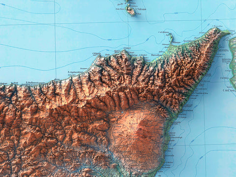
By the way with previous we announced a series of new maps on Italy Island maps: we are still working on it but they will come.


Comments (0)
There are no comments for this article. Be the first one to leave a message!