After a long wait, we are back with the story of a new map on demand!
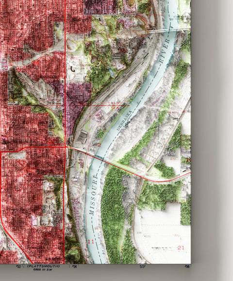
This time the request is for a map focused on the city of Omaha, Nebraska, and the delivery was supposed to be for Christmas.
In order to make the map of the specific area requested, a new map had to be created by combining four sheets of the maps made by the USGS. Then it was necessary to redraw the frame, standardise the colours, move the inscriptions so that it would be a homogeneous map and not a collage.


Original map credits:
mapped, edited and published by the Geological Survey.
Control by USGS and USC&GS. Topography from aerial photographs by Kelsh plotter.
From photographs taken in 1952. Photorevised in 1962.
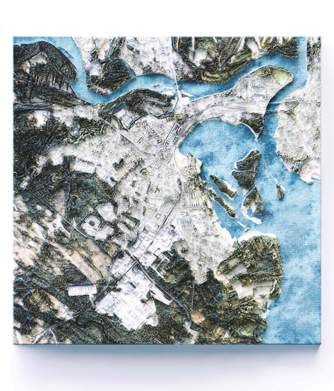
Next it was time for the satellite surveys. To obtain the necessary details we used Lidar, patiently and skilfully processed to give a clear and clean effect of the city's reliefs.

In the end the result, with the right colour correction and balancing to show the shadows well, but also the labels!

Commenti (0)
Non ci sono commenti per questo articolo. Sii il primo a lasciare un messaggio!